Terrex Seismic is invested in seeking out and utilising new technologies and employing new methods for acquiring on-shore seismic data.
The use of Terrex Seismic technologies provide our clients with the most innovative and cost effective seismic solutions.
Terrex Seismic leads the industry in environmentally responsible operations working with all stakeholders to produce successful outcomes through rigorous planning and assessment of each project.
An innovative way to minimise the environmental impact and optimise efficiency of seismic data acquisition is through Drone Aerial Mapping.
Why use drones
There are many new challenges facing today’s explorationists, namely to reduce costs for sustainable operation, optimise performance from existing reservoirs, and reduce the environmental footprint while finding new resources in increasingly difficult terrains.
Employing and integrating drone imaging and GIS mapping to assist with survey planning and positioning is Terrex Seismic’s unique approach to addressing some of these challenges.
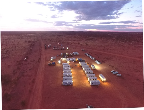
High quality (densely sampled) seismic data can be acquired efficiently and with a reduced environmental footprint by employing drone aerial mapping to manage both source (Vibrator) and receiver (Node) line and point positions. Source and Receivers are strategically positioned to:
- Reduce the requirement for vegetation clearing or ground disturbance
- Avoid difficult terrain that will adversely affect production rates
- Avoid surface topography and soil types that will decrease data quality
- Optimise positioning around existing infrastructure
- Improve security of data and equipment
How we use drones
Terrex Seismic employs large drones equipped with a range of cameras and equipment including visual and infra-red imagery, LIDAR (a remote sensing method that uses a pulsed laser to measure variable distances to the earth), gas-detecting sensors and differential global positioning systems (DGPS) to acquire ground imagery.
Large drones are used due to their increased payload and range resulting in high-resolution datasets. The DGPS provides highly accurate positioning of the acquired data sets. The drone images are uploaded to a Geographic Information System (GIS) for review and are used whilst planning surveys for optimal source and receiver line and point positioning.
The accurate positioning of the drone imagery thanks to the DGPS also means that the dataset can also serve as a valuable tool to assist with subsurface data interpretation.
All-round benefits
Integrating drone imaging with survey planning and design is of benefit to all clients commissioning a 2D or 3D seismic project as:
- Environmental impact will be reduced
- Data quality will be enhanced
- Production rates will be increased
- Cost effective and efficient seismic acquisition will be achieved
- Post survey environmental monitoring is simpler